Determine the values at risk and where they’re located

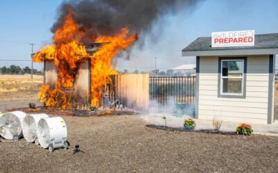
One key to mitigating hazards in the WUI is to develop detailed maps of the WUI areas in your district. The more detailed you can make them, the better. The first step in developing a map for use in the WUI is determining the information you’ll need. Image courtesy Tim Ryan
By Tim Ryan, FireRescue Magazine Issue 6 | Volume 8
As we all know, situational awareness (SA) is a key factor in firefighter safety. Accident investigators often find that poor SA plays a role in many incidents. Just like in structural firefighting, the wildland/urban interface (WUI) presents several challenges to our ability to develop adequate SA, but WUI-related challenges are much different than those found in the structural environment. Firefighters called to respond to a WUI fire will encounter complex hazards (e.g., different types of fuels, changes in weather, flammable/combustible elements such as propane tanks), unfamiliar terrain, inadequate escape routes and/or safety zones, and outdated or incorrect residential addresses.
One key to mitigating these hazards: a good map of the area that indicates hazards and identifies safe areas for firefighters. An up-to-date, highly detailed map of our WUI areas will help us identify values at risk quickly and will ensure that we make sound risk/reward-based decisions before we enter any WUI fire area.
Map Making, Step 1
The first step in developing a map for use in the WUI is determining the information you’ll need. Detailed maps of a WUI area should include structure locations, water sources and safety zone and escape route locations. If you’ve got an electronic map, you can embed much more detailed information, including home assessment details, bridge weight limits and utility hazards, such as propane tanks, power lines, septic tanks, etc.
If you’re just getting started on compiling a list of information that you’d like to have available to you in map form, remember that it’s good to start early; think big and think ahead. Get out in your response area and gather as much information as you possibly can in the timeframe that you have to obtain it. It may sound time-consuming, but it’s much easier to collect all the data that you’d like in your map in one trip to the field, and the more information you have on your maps, the greater SA you’ll have when a major WUI fire erupts.
When evaluating your community, take an overall look at your WUI areas and determine the values at risk and where they’re located. Ask yourself: How easy would it be to access this location during a WUI incident, and how easy would it be to escape if needed? The more difficult or limited the access, the more detail you’ll want to include in your map. What resources will be required? Is the area hydranted, or will you need water tenders, and if so, will they be able to access the location safely and easily? What kind of terrain will you be operating in: rocky, muddy, dry, sloping? What hazards are nearby and how can you mitigate them?
Area Considerations
The second step in the process is determining where and how to collect this information. Densely developed WUI areas most likely have detailed maps already due to increased planning efforts by local government; the more rural the WUI area is, however, the less likely you are to have good, highly developed maps for it. Tip: If you must respond in a rural WUI area, check in with your local planning department or county GIS department to see if they can provide updated information. Federal cooperators, such as the Bureau of Land Management, the U.S. Forest Service or other agency, will likely have electronic map layers that they can share with you. With a little leg work and basic knowledge of modern GIS tools, any department can create maps to help mitigate some WUI hazards and increase firefighter SA.
There are also many new and emerging applications for iPads, smart phones and computers that can provide detailed information for very little cost. Do some research; most of the information you’re going to want in your maps is likely already available electronically as a layer.
Reality Check
Departments can also start to build their SA of WUI areas simply by taking a look at currently available maps of subdivisions, residential developments and rural areas, and then taking a drive out into the specified area to see what’s accurately portrayed on the map and what’s not. Many will be surprised to find that there are new houses where there were once open fields, wildland fire fuels have changed and/or roads may not go where they once did. Tip: Compare reality with what your old maps indicate. This will be your first clue as to whether your department needs to undertake some WUI map-making of their own.
Data Collection
If you’re fortunate enough to have good map data available, you can use this data as the foundation for your WUI mapping system. You can then look over your list of information that you’d like included on your map and start collecting it. There are several ways to do this. Note: The more GIS skills you possess or have access to, the more efficient your data collection process can be.
Start by taking a drive out to a small subdivision or rural area. Stop at each house and take a GPS reading on the coordinates. It’s helpful to take a few notes while you’re there, and maybe even a photograph. Some good notes to include: the address as posted (which is often not what it should be in rural areas), and any hazards you may note (e.g., difficult access, one way in and out, etc.).
This is also an opportune time to collect data on available water sources in the area as well as safety zones for firefighters and equipment; take coordinates on those too.
This exercise can be incorporated into WUI training with great success. It can be developed into a GIS unit, district familiarization and WUI hazard training, which can also produce a lot of useful data for your WUI maps.
Bringing It All Together
Once you get an area covered, you can download the information off of the GPS unit and create a map that shows points where the homes are located; this file can then be correlated with street maps and aerial images when put in the hands of a department member with some knowledge of basic GIS software.
The data from your notes can also be combined to provide a graphical database that will clue you into the hazards of a particular area when the map is viewed on a computer. New technology is also out now that allows the creation of PDF maps with embedded GIS information. These documents can be stored on your computer or mobile device for quick reference. Remember: You can include anything you want on a map: water sources, bridges, hazards, power lines, anything that you think will help you better access the location and understand its topography and hazards.
Conclusion
Thanks to modern technology, we’re able to create up-to-date, highly detailed maps of just about any area these days. And the information we collect and implement can truly be life-saving when faced with a major WUI fire.
The WUI is a complex, challenging environment, and if firefighters don’t have a good grasp of their surroundings when deployed, their SA can be compromised, leading to injury or worse. So take the time now to get out in your response area, and develop a map that helps fortify your SA.
Timothy Ryan is the assistant chief of operations for Red Lodge Fire Rescue (RLFR). He has served as a both a firefighter and a paramedic for RLFR since 2004. Currently, Ryan works with the State of Montana Department of Natural Resources and Conservation (DNRC) as an instructor and a wildland firefighter. He also qualifies as a task force leader and a Type 4 incident commander and serves as the coordinator for the Southern Zone Interagency Fire Council in south central Montana. Ryan holds an associate’s degree in fire science from Montana State University.